Many researchers agree that the success of research hinges on engaging the main actors in the field of study from the very beginning. In the case of environmental projects in protected areas, such as Ecopotential, these actors are the direct managers of these areas.
Francisco Javier Bonet, a researcher at the University of Cordoba and a member of the project team, explained that there is a gap between researchers and decision-makers and that, for this reason, one of the European Ecopotential project’s achievements has been to bridge the rift between the two. "The managers of the protected areas expressed the problems and needs they had. From there, the researchers got to work," he says. This approach meant that the managers felt that they were being listened to, and the results were intelligible to them.
Ecopotential, part of the Horizon 2020 programme, involved 47 teams working on the study of 23 protected areas in Europe for the conservation, management and restoration of terrestrial and marine ecosystems in the face of anthropogenic pressures. Satellite imagery was used to quantify ecosystem services and improve the way protected areas are managed. In this way, the objective at the local level transcended to a global one because "it was possible to establish synergies between different mountain parks, which asked for information to be generated on climate projections in the future, for example. And the general data could be applied to regional models, producing synergies," Professor Bonet explained.
Central to achieving these objectives was effective monitoring and modelling of the status of and trends in ecosystem conditions and services. The human footprint on ecosystems was monitored via remote sensing, which involves identifying objects or changes on the Earth's surface using satellites. This information was then used to improve the way Europe's protected areas are managed.
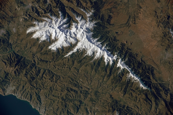
In Spain, work was carried out in Doñana and Sierra Nevada. In the former, progress was made in understanding how the water regime of the marshes there works. In Sierra Nevada, a map was drawn up predicting temperature changes in this mountain massif over the next 70 years.
In addition to the data collected over the course of the project, an extensive time series of images recorded by European satellites over several decades was used. "A lot of information has been inherited from space agencies, and helps us to understand what is happening today," says Professor Bonet, using the example of forest deforestation seen in these time series.
For Ecopotential, the fundamental focus was to showcase the value of this information, not only for scientists, but also for decision-makers who do not have access to this type of data, which is sometimes difficult to use.
The virtual platform is still being developed, and will be integrated into the Life Watch research infrastructure, which processes European biodiversity data; and into Copernicus, which manages satellite imagery in Europe.
The aim is to continue the legacy of the Ecopotential project, compiling data from all over Europe, with information covering multiple variables: climate data, satellite images, the photosynthetic activity of vegetation, and the presence of species, among others.
The ECOPOTENTIAL project - "Improvingfutureecosystembenefitsthroughearthobservations" (H2020-SC5-16-2014-641762) has been funded by the European Union through the H2020-SC5-16-
"This report is part of the project “CONSOLIDA-UCO ECT2020-000810", funded by MCIN/AEI/10.13039/501100011033 and by European Union “NextGenerationEU”/PRTR”.


